After tropical storm Hanna churns off the east coast of Florida early Friday morning, hurricane Ike, moves west across the open Atlantic.
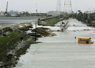
The two storms come on the heels of hurricane Gustav, which hit Louisiana on Sept. 1. . Although the storm just sideswiped its city as a Category 2 hurricane, other parts of the state were flooded by Gustav's heavy rains.
Ike's eye was just east of Great Inagua Island in the southeastern Bahamas, with maximum sustained winds of 135 mph. It was moving west-southwest at 14 mph and was expected to remain a major hurricane. The U.S. National Hurricane Center said Ike's eye was expected to move over eastern Cuba Sunday night and into central Cuba on a track that will likely take it into the Gulf of Mexico.

The evacuation of New Orleans becomes mandatory at 8 a.m. Sunday along the vulnerable west bank of the Mississippi River, and at noon on the east bank. Mayor of New Orleans emphasized that the city will not offer emergency services to anyone who chooses to stay behind.
Gustav had already killed more than 80 people in the Caribbean, and if current forecasts hold up, it would make landfall Monday afternoon somewhere between the East Texas and western Mississippi.
Forecasters at the National Hurricane Center said they were surprised at how quickly Gustav gained strength as it slammed into Cuba's tobacco-growing western tip. It went from a tropical storm to a Category 4 hurricane in about 24 hours, and was likely to become a Category 5 — with sustained winds of 156 mph or more — by Sunday.
Levee building on the city's west bank was incomplete, a storm surge of 15 to 20 feet would pour through canal and flood the neighboring Jefferson Parish.
The National Hurricane Center also issued a hurricane watch for Alabama, Mississippi, Louisiana and part of Texas, meaning hurricane conditions are possible within 36 hours.


